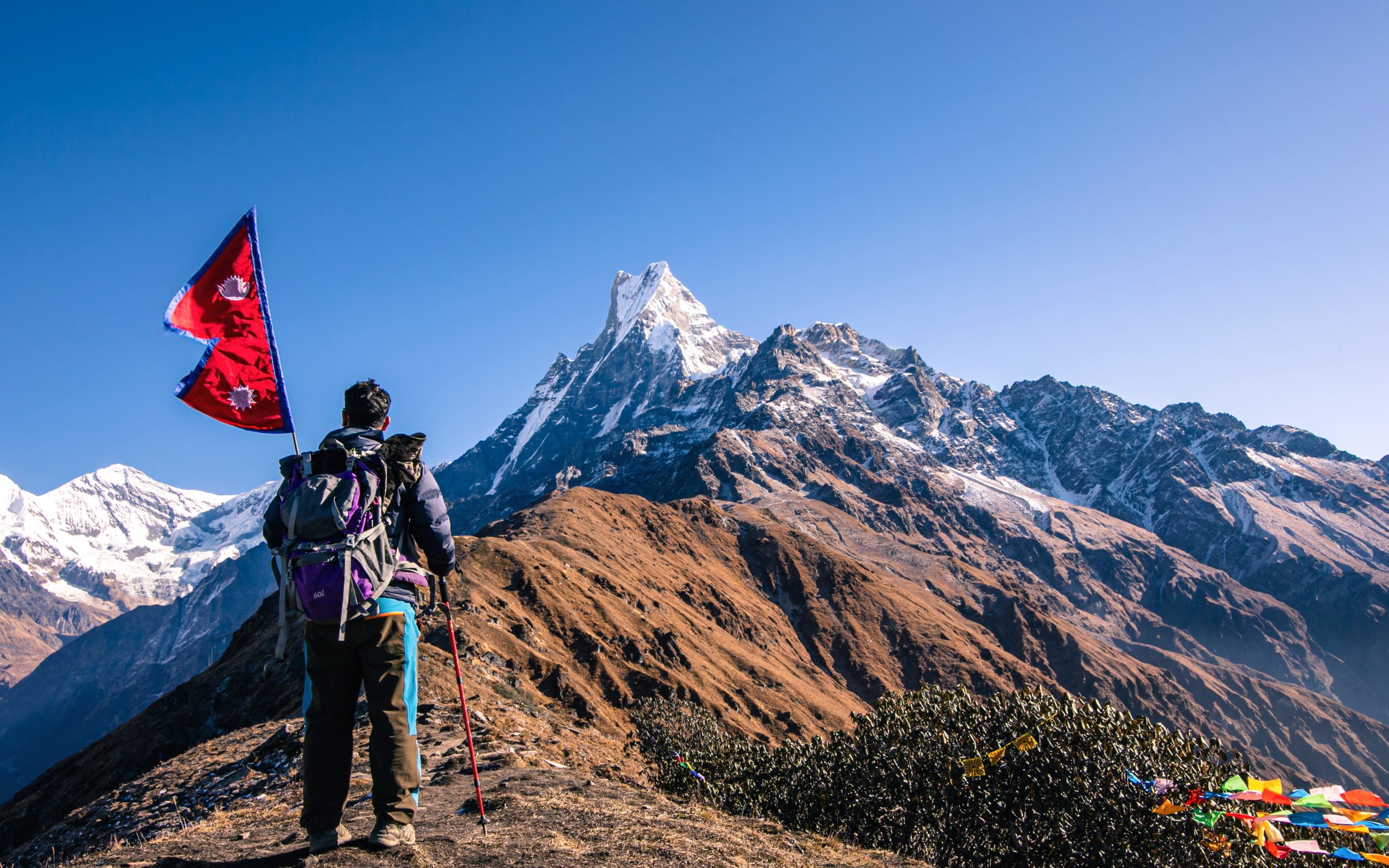
East of the well-known Annapurna Base Camp circuit in Nepal’s Annapurna region lies the stunning and relatively new Mardi Himal Base Camp Trek. At Mardi Himal Base Camp, which is 4,500 meters (14,763 feet) above sea level, trekkers can enjoy breathtaking sweeping views of Annapurna South, Machapuchare (Fishtail), and Mardi Himal itself. Although the track is shorter and less congested than many other well-known treks in Nepal, it is regarded as somewhat challenging due to its steep sections and is usually finished in 5 to 8 days. Trekkers go 45 to 65 kilometers, starting with a drive from Pokhara to Kande or Phedi. From there, they traverse alpine scenery, lush forests, and stunning ridge lines. This journey is best done in the spring (March to May), when rhododendrons are in full bloom, and in the fall (September to November), when the sky is clear and the views of the mountains are at their best.
Highlights
- Can see panoramic views of Hiunchuli, Annapurna South, Machapuchare (Fishtail), and the actual Mardi Himal.
- Less crowded and more serene and untamed than climbs to Poon Hill and Annapurna Base Camp.
- Hiking through high alpine fields, ridge-line trails, and deep woodlands.
- High Camp offers stunning views of the dawn and sunset.
- Genuine local experience—newly constructed lodges, tiny settlements.
Quick Summary
| Max Altitude | 4,500m |
| Duration | 5–8 days |
| Difficulty | Moderate |
| Best Time | Spring & Autumn |
| Permits | TIMS + ACAP |
| Starting Point | Pokhara/Kande |
Typical Itinerary (Standard 10 Days)
Day 1
Drive from Pokhara to Kande (~1 hour), trek to Australian Camp or Pothana
Day 2
Trek to Forest Camp (Kokar)
Day 3
Trek to Low Camp
Day 4
Trek to High Camp
Day 5
Early morning hike to Mardi Himal Base Camp and back to High Camp; trek down to Low Camp
Day 6
Trek down to Siding Village, drive back to Pokhara
Day 7
Buffer day for weather or to explore Pokhara
Note: By descending more quickly, some trekkers cut it even shorter (4 days).
Trekking Permit Requirements
Two permits are required:
- Trekkers’ Information Management System (TIMS) Card
- Price: around NPR 2,000 (USD 15–20)
- The Annapurna Conservation Area Project’s ACAP Permit
- Costs approximately NPR 3,000 (USD 22–25).
✅ It is easy to arrange these in Pokhara or Kathmandu.
Accommodation and Food
- Teahouses/Lodges: Comfortable but simple. Hot showers and WiFi usually available (for a fee).
- Food: Dal Bhat (Nepalese meal), fried rice, noodles, soups, pasta, tea and coffee.
- Food gets simpler and more expensive as you move up (due to the challenges of transportation).
Important Tips
- Fitness: Trekking is similar to ABC, so good to have a basic level of cardiovascular fitness, but get ready by walking, running, or trekking first.
- Altitude Sickness:
➔ Go slowly. Drink plenty of water.
➔ Headache, nausea, and lightheadedness are symptoms.
➔ Diamox is one medication that can help prevent AMS. - Packing List Must-Haves:
- Comfortable hiking boots
- Layered warm clothing
- Trekking stick/poles
- Water purification tablets or bottle
- Sleeping bag(optional)
- Rain gear(optional)
- Travel Insurance: Make sure that it covers walking up to 4,500 meters and helicopter evacuation.
Alternative Routes
- Mardi Himal + Australian Camp route: Spend more leisurely time at Pothana or Australian Camp.
- Mardi Himal + Annapurna View Point: Spend more time on the Annapurna South side if you have more days.
- Exit from Siding or Landruk: Various destinations to see additional nearby settlements.
Why People Love the ABC Trek?
- It is brief and to the point, ideal for anyone with less than a week to spare.
- Walking over the ridge offers breathtaking views, which some claim are better than ABC!
- Peaceful and quieter and less crowded
- Discover genuine local life in communities that are not overrun by tourists.
Fun Fact
A British expedition reached the summit of Mardi Himal for the first time in 1961, but it was not until 2012 that trekkers could access the base camp.
Looking for Help?
Do you also like me to make a sample, comprehensive, day-by-day itinerary that includes elevations, anticipated trekking hours, and pictures? 📸 🚶 If you are considering doing it, it can help you plan even more effectively! “✨” Contact us for help.
